Leipzig, Gerbergasse 30 (Q482107): Difference between revisions
Jump to navigation
Jump to search

(Created claim: Coordinate location (P48): 51°20'53.8566"N, 12°22'33.4434"E) |
(Added reference to claim: Wikimedia Commons archival document reproductions (P1089): StadtAL 0008 Nr 3175 Seite 352.jpg, #quickstatements; #temporary_batch_1712777180963) |
||||||||||||||
| (56 intermediate revisions by 2 users not shown) | |||||||||||||||
| Property / <Street or place of address> | |||||||||||||||
| Property / <Street or place of address>: Leipzig, Gerbergasse / rank | |||||||||||||||
| Property / Address name(s) | |||||||||||||||
| Property / Address name(s): Brandkataster alt 1130 / rank | |||||||||||||||
| Property / Address name(s) | |||||||||||||||
| Property / Address name(s): Brandkataster neu 1416 / rank | |||||||||||||||
| Property / Coordinate location | |||||||||||||||
| |||||||||||||||
| Property / Coordinate location: 51°20'53.8566"N, 12°22'33.4434"E / rank | |||||||||||||||
| Property / Localisation | |||||||||||||||
| Property / Localisation: Leipzig, Gerbergasse / rank | |||||||||||||||
Normal rank | |||||||||||||||
| Property / Address name(s) | |||||||||||||||
Brandkataster neu 1406 | |||||||||||||||
| Property / Address name(s): Brandkataster neu 1406 / rank | |||||||||||||||
Normal rank | |||||||||||||||
| Property / Address name(s): Brandkataster neu 1406 / qualifier | |||||||||||||||
Begin date: 1842
| |||||||||||||||
| Property / Address name(s): Brandkataster neu 1406 / reference | |||||||||||||||
| Property / Address name(s) | |||||||||||||||
Brandkataster alt 1141 | |||||||||||||||
| Property / Address name(s): Brandkataster alt 1141 / rank | |||||||||||||||
Normal rank | |||||||||||||||
| Property / Address name(s): Brandkataster alt 1141 / qualifier | |||||||||||||||
End date: 1842
| |||||||||||||||
| Property / Address name(s): Brandkataster alt 1141 / reference | |||||||||||||||
| Property / Coordinate location | |||||||||||||||
51°20'51.432"N, 12°22'37.045"E
| |||||||||||||||
| Property / Coordinate location: 51°20'51.432"N, 12°22'37.045"E / rank | |||||||||||||||
Normal rank | |||||||||||||||
| Property / Coordinate location: 51°20'51.432"N, 12°22'37.045"E / reference | |||||||||||||||
| Property / Wikimedia Commons archival document reproductions | |||||||||||||||
| Property / Wikimedia Commons archival document reproductions: StadtAL 0008 Nr 3171 Seite 147.jpg / rank | |||||||||||||||
Normal rank | |||||||||||||||
| Property / Wikimedia Commons archival document reproductions: StadtAL 0008 Nr 3171 Seite 147.jpg / qualifier | |||||||||||||||
Address name(s): Brandkataster alt | |||||||||||||||
| Property / Wikimedia Commons archival document reproductions: StadtAL 0008 Nr 3171 Seite 147.jpg / qualifier | |||||||||||||||
Begin date: 1807
| |||||||||||||||
| Property / Wikimedia Commons archival document reproductions: StadtAL 0008 Nr 3171 Seite 147.jpg / qualifier | |||||||||||||||
End date: 1808
| |||||||||||||||
| Property / Wikimedia Commons archival document reproductions: StadtAL 0008 Nr 3171 Seite 147.jpg / reference | |||||||||||||||
| Property / Wikimedia Commons archival document reproductions | |||||||||||||||
| Property / Wikimedia Commons archival document reproductions: StadtAL 0008 Nr 3172 Seite 097.jpg / rank | |||||||||||||||
Normal rank | |||||||||||||||
| Property / Wikimedia Commons archival document reproductions: StadtAL 0008 Nr 3172 Seite 097.jpg / qualifier | |||||||||||||||
Address name(s): Brandkataster alt | |||||||||||||||
| Property / Wikimedia Commons archival document reproductions: StadtAL 0008 Nr 3172 Seite 097.jpg / qualifier | |||||||||||||||
Begin date: 1808
| |||||||||||||||
| Property / Wikimedia Commons archival document reproductions: StadtAL 0008 Nr 3172 Seite 097.jpg / qualifier | |||||||||||||||
End date: 1810
| |||||||||||||||
| Property / Wikimedia Commons archival document reproductions: StadtAL 0008 Nr 3172 Seite 097.jpg / reference | |||||||||||||||
| Property / Wikimedia Commons archival document reproductions | |||||||||||||||
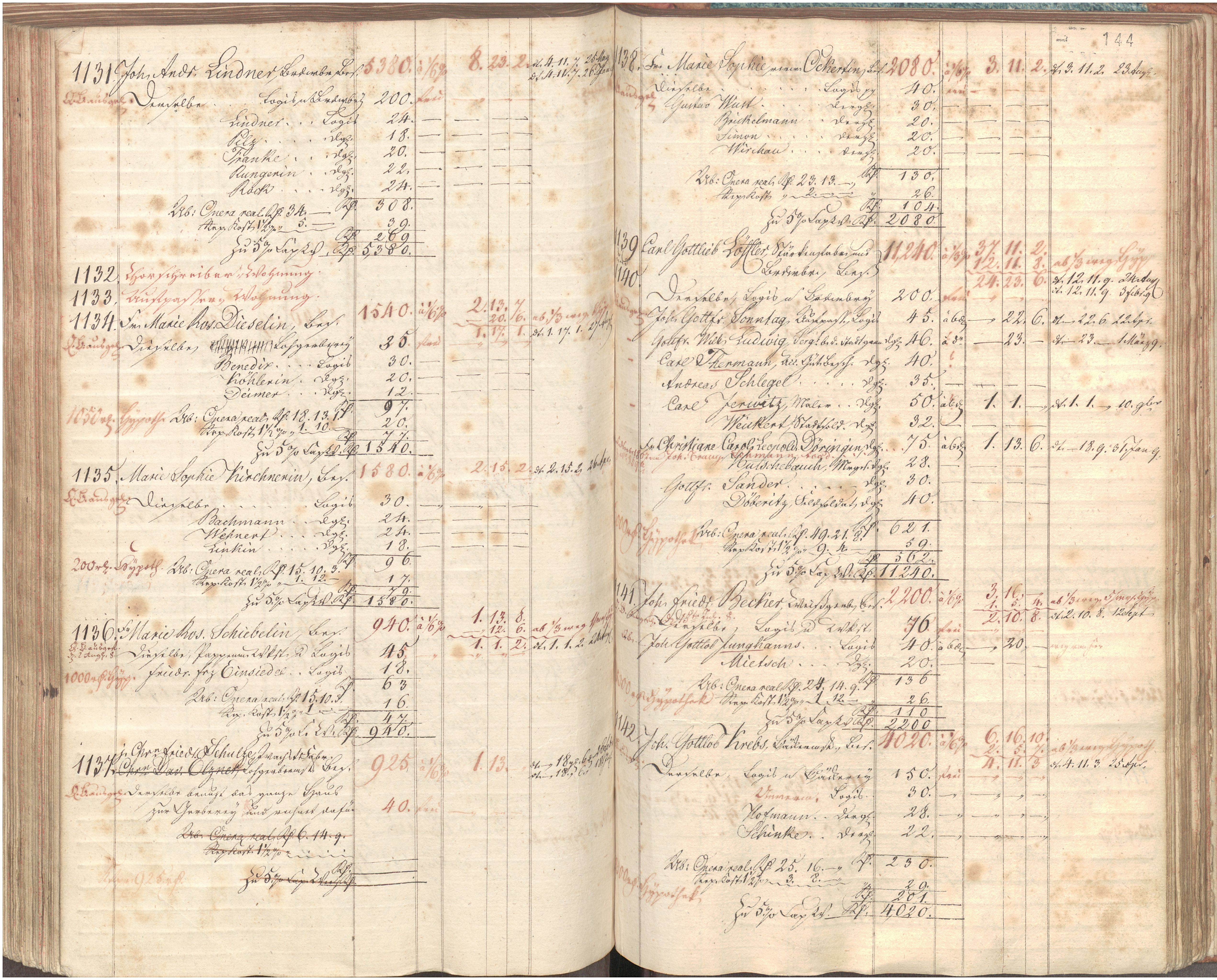
| Property / Wikimedia Commons archival document reproductions: StadtAL 0008 Nr 3175 Seite 351.jpg / rank | |||||||||||||||
Normal rank | |||||||||||||||
| Property / Wikimedia Commons archival document reproductions: StadtAL 0008 Nr 3175 Seite 351.jpg / qualifier | |||||||||||||||
Address name(s): Brandkataster alt | |||||||||||||||
| Property / Wikimedia Commons archival document reproductions: StadtAL 0008 Nr 3175 Seite 351.jpg / qualifier | |||||||||||||||
Begin date: 1810
| |||||||||||||||
| Property / Wikimedia Commons archival document reproductions: StadtAL 0008 Nr 3175 Seite 351.jpg / qualifier | |||||||||||||||
End date: 1823
| |||||||||||||||
| Property / Wikimedia Commons archival document reproductions: StadtAL 0008 Nr 3175 Seite 351.jpg / reference | |||||||||||||||
| Property / Wikimedia Commons archival document reproductions | |||||||||||||||
| Property / Wikimedia Commons archival document reproductions: StadtAL 0008 Nr 3175 Seite 352.jpg / rank | |||||||||||||||
Normal rank | |||||||||||||||
| Property / Wikimedia Commons archival document reproductions: StadtAL 0008 Nr 3175 Seite 352.jpg / qualifier | |||||||||||||||
Address name(s): Brandkataster alt | |||||||||||||||
| Property / Wikimedia Commons archival document reproductions: StadtAL 0008 Nr 3175 Seite 352.jpg / qualifier | |||||||||||||||
Begin date: 1810
| |||||||||||||||
| Property / Wikimedia Commons archival document reproductions: StadtAL 0008 Nr 3175 Seite 352.jpg / qualifier | |||||||||||||||
End date: 1823
| |||||||||||||||
| Property / Wikimedia Commons archival document reproductions: StadtAL 0008 Nr 3175 Seite 352.jpg / reference | |||||||||||||||
Latest revision as of 22:02, 11 April 2024
No description defined
| Language | Label | Description | Also known as |
|---|---|---|---|
| English | Leipzig, Gerbergasse 30 |
No description defined |
Statements
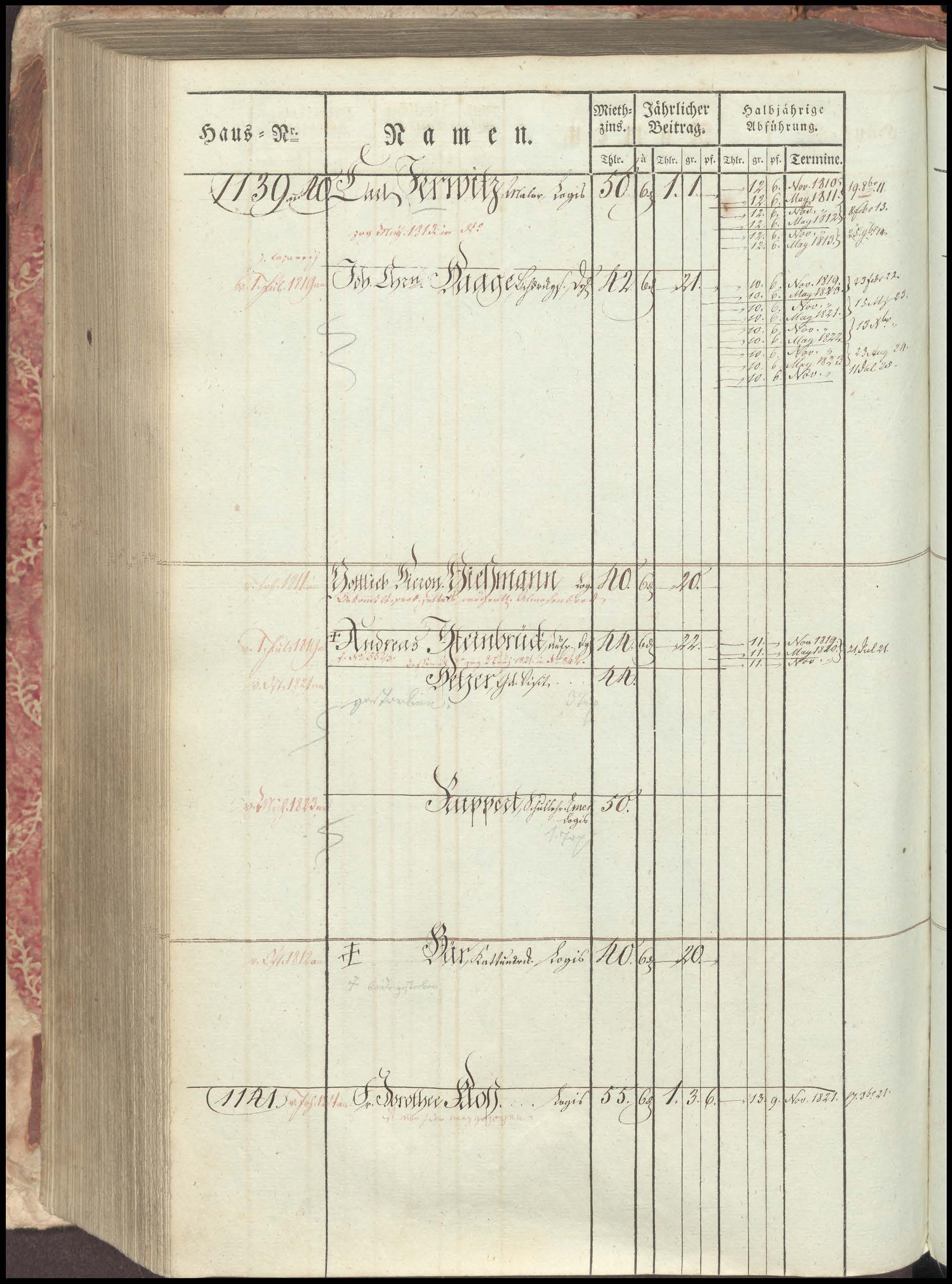
Brandkataster neu 1406
1842
Brandkataster alt 1141
1842
51°20'51.432"N, 12°22'37.045"E

StadtAL 0008 Nr 3171 Seite 147.jpg
5,083 × 4,095; 3.87 MB
5,083 × 4,095; 3.87 MB


StadtAL 0008 Nr 3175 Seite 351.jpg
1,951 × 2,632; 372 KB
1,951 × 2,632; 372 KB

StadtAL 0008 Nr 3175 Seite 352.jpg
1,800 × 2,625; 413 KB
1,800 × 2,625; 413 KB